| Cwm Cau |
4.5 miles, 2,500ft of ascent. Doesn't sound far, but you'll notice that with that amount of ascent, in that short distance, the gradient is severe. Also, this walk goes around the lake; October 2009 was the first time I ever walked round the lake; it's not easy as there are several places that require all fours (at least, for an old chap like me!) It's especially scrambly, and a bit bog-hoppy, just here. The ascent from the car park, through the woods, with Nant Cadair tumbling down beside you is quite magic ... but if you like your walks solitary, keep away from summer and public holidays as this is a very popular route. Three interesting geocaches; Roche Moutonée is especially interesting. And I didn't really understand the Troll until I saw my own photo of it! Park on the red circle below, and either load the GPX file into your GPS, or follow your nose! On this map, follow the stairs up through the woods, through the gate until you get to the pasture. From there you need to be following the GPS, or doing some proper map reading.
|

|
© Copyright Jeff Buck and licensed for reuse under this Creative Commons Licence
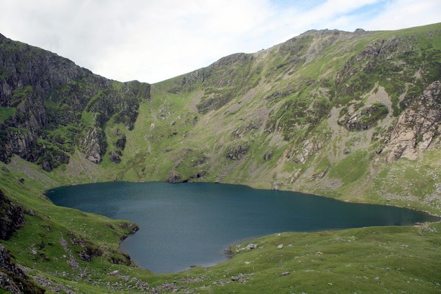
See other pictures of Llyn Cau here.
To download GPX Files, right-click the link, choose Save Link As ..., and save it to wherever you keep route files.
See the documentation that came with your GPS for information on how to download the route to your GPS.
These are a selection of Ordnance Survey Maps that cover this walk.
Geocaches on route
Blog
Pictures
(Click on thumbnails for full-size pics.)

Dog with roche moutonee (I hope; if not I haven't understood!)
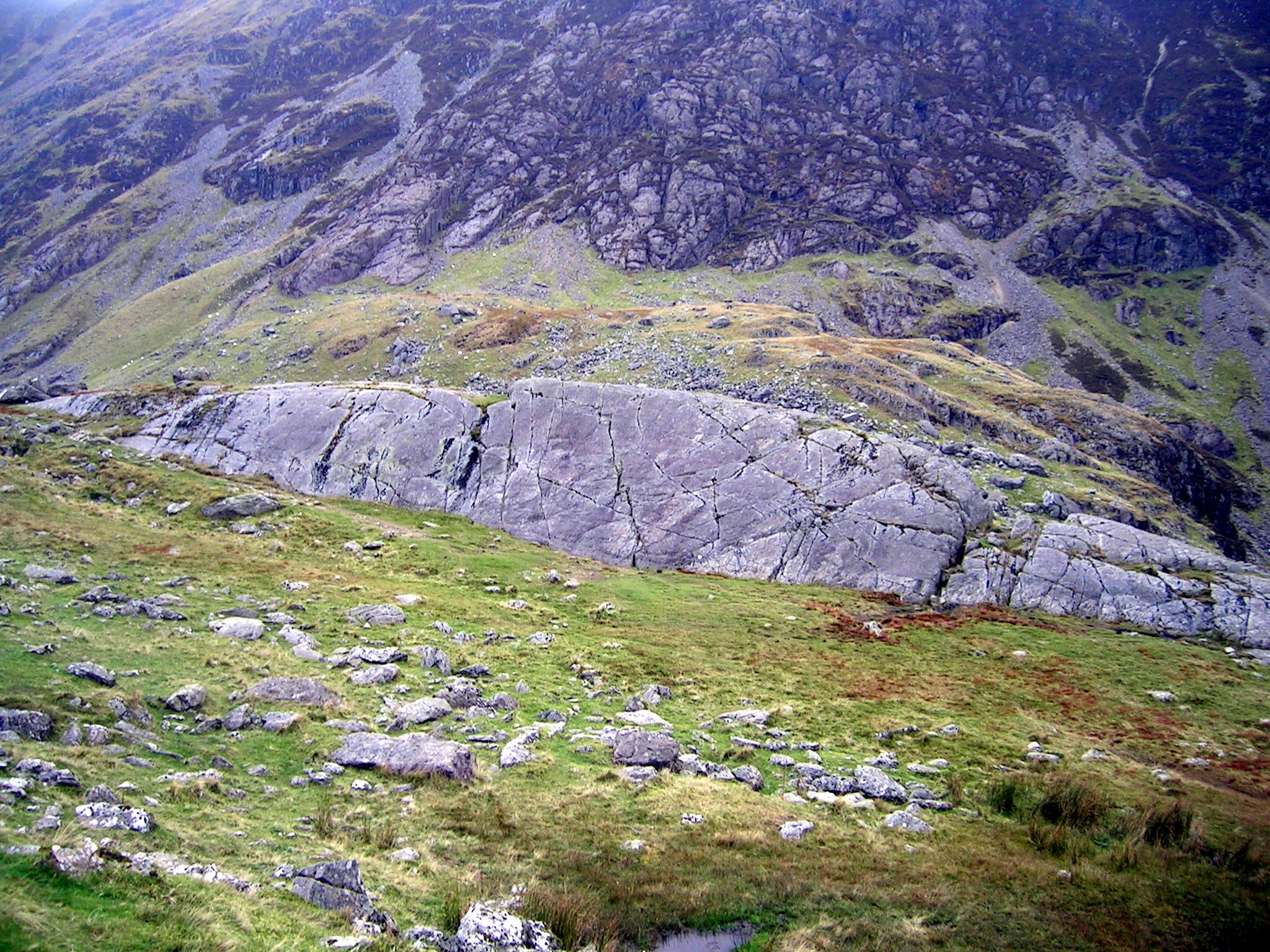
Roche moutonee east of the llyn.

There's a troll there somewhere! The Minffordd path to the summit is on the sky-line.
